


Boucle La Crabiere - Hbt Assier

Lamartiniere
User GUIDE
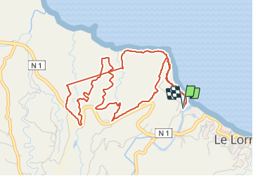

Length
8.5 km

Max alt
106 m

Uphill gradient
239 m
Km-Effort
11.7 km

Min alt
3 m

Downhill gradient
240 m
Boucle
Yes
Creation date :
2022-03-13 12:18:17.346
Updated on :
2022-03-13 15:46:21.057
3h00
Difficulty : Medium

FREE GPS app for hiking
 SityTrail
IGN / Geographical institutes
SityTrail Plus
The world is yours!
About
Trail Walking of 8.5 km to be discovered at Martinique, Unknown, Le Lorrain. This trail is proposed by Lamartiniere.
Description
Prospection de rando. Demande d'autorisation pour randonner dans la bananeraie Assier. Se munir d'une carte, de nombreux talwegs à traverser.
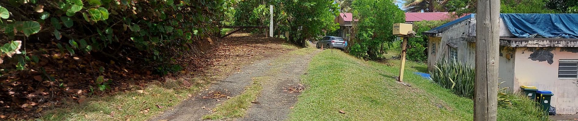
Photos


Positioning
Country:
France
Region :
Martinique
Department/Province :
Unknown
Municipality :
Le Lorrain
Location:
Unknown
Start:(Dec)
Start:(UTM)
708475 ; 1641135 (20P) N.
Comments